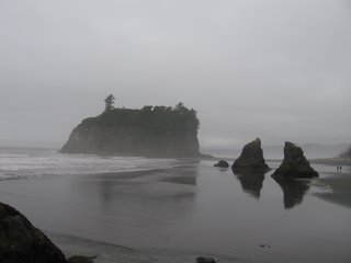
1. Life's a (rocky) beach: We decided to hit the farthest point of our trip first, so we drove for nearly two hours through winding roads to reach Ruby Beach, made up mostly of rocks which evidently do have a pinkish hue to them at times (though not today). A brave few of us waded in the frigid water for a few minutes, and then we spent the rest of the time climbing around on the large rock structure and seeing things like live mussels and even a sea anemone. The weather was cloudy and in the lower 60's, so we didn't stay long. (You can see a cool panoramic picture of the beach here.)
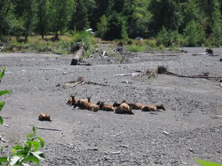
2. The Hoh truth. Our next stop was the Hoh Rain Forest, one of the few such forests in the United States. (And yes, since we were a bunch of musicians and mostly guys, the "Hoh" jokes ran rampant throughout the day, although it's actually named after the river that runs through the area and the Indian tribe that lived there.) We took one of the shorter trails, the Hall of Mosses, which was really amazing. We also had a picture of the whole band taken in front of a 270-foot-tall, 500-year-old tree that was appropriately named the Big Spruce Tree. On the way in, we stopped to take pictures of a good-sized herd of elk that were resting near the river bed. A panoramic shot of the Hall of Mosses can be found here.
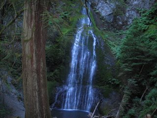
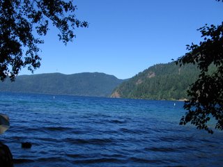
3. Great falls. After dining at Pacific Pizza in the town of Forks (the largest one inside the national park), we embarked upon the third leg of our adventure: a trip to Marymere Falls near the lovely Lake Crescent. When we drove past it this morning, I noted that nearly every picture that could be taken of that lake would be postcard-worthy, and Highway 101 winds around a generous portion of it. After a shorter-than-expected (but very steep in places) hike up the trail to the falls, we stopped by the shore of the lake to get a bunch of pictures (which again will be up here shortly after I get back home). The glacial lake has clear, cold water and tree-topped mountains in the background. Again, check out the panoramic view here.
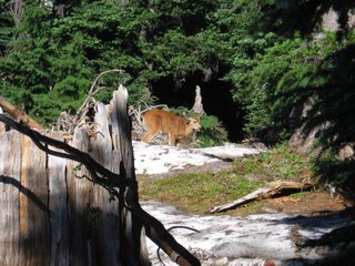
4. The mile-high club, in a way. Our last destination of the day was a trip up to Hurricane Ridge, which, according to the GPS in our van, is 5190 feet above sea level. It doubles as a ski area in winter (which is defined here as October through April), but in summer, it offers spectacular views of snow-capped mountains to the south (and we even found a bit of snow ourselves today) and the chance to see all the way to Canada from the north. We also saw a deer feeding nearby and got a few pictures. A Ridge-Cam can be found here, and a panoramic picture from the visitors' center is located here.

Dinnertime brought us down to 22 feet above sea level (only because we had to park upstairs), as we took the Hurricane Ridge road north into Port Angeles for a delicious dinner at Downriggers on the waterfront. A lot of us had clam chowder in a bread bowl, just like we'd had in Vermont last summer, only this stuff was even better. It was a great way to cap off a long but productive day.
I realize that my travelogue
Oh, and go back to yesterday's post for updates to the "what's in a name" section.
Jumpin' for java joy: I knew that this area was really into its coffee (being the home of Starbucks and all that), but it's really hit home during these travles just how bean-crazy it is up here. Every small town has multiple coffee places, and even the most unlikely venues (bait shops, video stores) advertise espresso. It's my goal to try as much local coffee as possible while I'm here. (UPDATE: My favorite weird coffee place so far has been the place that advertises HOT DOGS, OYSTERS and ESPRESSO...but nobody has been brave enough to stop there yet.)

No comments:
Post a Comment